
Brahmaputra: Water Race Between India And China – OpEd
As the news about diversion of water of Brahmaputra published in Chinese media on 29 October ’17, it invites much repercussion from different fields in India and Bangladesh. People have expressed deep concern over diversion plan of China. Though China denied the report as false and baseless, it fails to nutralise the concern.
According to the published report China plans to divert waters of the river to drought effects Xinjiang and Taklimakan desert in the region. Chinese engineers have submitted a plan of building a 1,000 km tunnel to divert from Tibet to arid region in the north of Tibet, reports Stephen Chen.
The South China Morning Post, opines the plan if approved, would have huge ramifications for downstream India and Bangladesh, envisages building the world’s longest tunnel to carry billions of tons of water from Tibet to the nothern arid region.
Wang Wei, a researcher who helped draft the latest Tibet-Xinjiang water tunnel proposal, which was submitted to the central government in March, said more than 100 scientists formed different teams for the nationwide research effort. The researchers estimated the tunnel would be able to carry 10 billion to 15 billion tonnes of water from the Yarlung Zangbo (Tsangpo) River to the Taklimakan Desert each year.
The team he was part of was led by China’s top tunnelling expert, Wang Mengshu. It suggested the government drain the Yarlung Tsangpo River at Sangri county in southern Tibet, near the disputed border with India.
It is said an artificial island would be built in the middle of the river to create rapid turbulence, which could filter out sediment, and direct water to a well. The well could control the amount of water flowing into the tunnel.
The Brahmaputra project’s enormous cost, engineering challenges, possible environmental impact and the likelihood of protests by neighbouring countries have meant it has never left the drawing board, but Zhang Chuanqing said China was now taking a quiet, step-by-step approach to bring it to life. Chuanqing is a researcher at the Chinese Academy of Sciences’ Institute of Rock and Soil Mechanics in Wuhan who is involved in the Yunnan plan.
Researchers revealed building the Yunnan tunnel would be a “rehearsal” of the new technology, engineering methods and equipment needed for the Tibet-Xinjiang tunnel, which would divert the Yarlung Tsangpo River in southern Tibet to the Taklimakan Desert in Xinjiang.
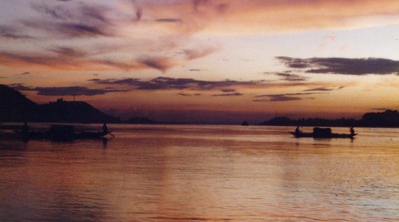
The Brahmaputra is a rain-fed river and it carries rain water during winter also. It is possible because the a huge amount of rain water stored underground and it gives rivers water during winter when rain is rare. Moreover a substantial amount of glacial water comes from Tibet. In India, specially Assam gets a huge volume of water in Brahmaputra which is many times more than the water enters in Indian from Tibet. Of course, in winter, large amount of water comes from Tibet which is glacial water. Brahmaputra flows through economically less developed ethnic minority regions of India, Bangladesh and China.
China’s cutting off the flow of a Brahmaputra tributary is just the latest example of its emergence as the upstream water controller through a globally unparalleled hydroengineering infrastructure centred on dams.
Earlier, Beijing itself highlighted its water hegemony over downstream countries by releasing some of its dammed water for drought-hit nations in the lower Mekong basin.
Blocking the flow of the Xiabu river, a Yarlung Zangbo tributary, through a dam project is a significant development, a forewarning that China intends to do a lot more to re-engineer flows in the Brahmaputra system by riding roughshod over the interests of the lower riparian, India and Bangladesh.
On the Mekong, China has erected six giant dams, with the smallest of them bigger than the largest dam India has built since Independence.
For the downriver countries in that basin, the release of water from the Chinese dams to combat drought was a jarring reminder of not just China’s newfound power to control the flow of a life-sustaining resource, but also of their own reliance on Beijing’s goodwill and charity.
Armed with such leverage, Beijing is pushing its Lancang-Mekong Cooperation (LMC) initiative as an alternative to the lower-basin states’ Mekong River Commission, which China has spurned over the years.
China is a dialogue partner but unfortunately not a member of the Mekong River Commission, underscoring its intent to stay clued in on the discussions, without having to take on any legal obligation.
Asia’s water map changed fundamentally after the communists took power in China in 1949. It wasn’t geography but guns that established China’s choke-hold on almost every major transnational river system in Asia, the world’s largest and most-populous continent.
Beijing’s claim over these sprawling territories, which make up more than half of China’s landmass today, drew from the fact that they were imperial spoils of the earlier foreign rule in China.
Before the communists seized power, China had only 22 dams of any significant size. But now, China boasts more large dams on its territory than the rest of the world combined. If dams of all sizes and types are counted, their number in China surpasses 85,000. Strongman Mao Zedong initiated an ambitious dam-building programme, but the majority of the existing dams were built in the period after him.
Despite its centrality in Asia’s water map, China has rebuffed the idea of a water-sharing treaty with any neighbour. Concern is thus growing among its downstream neighbours that China is seeking to turn water into a potential political weapon.
China is clearly not content with being the world’s most dammed country, and the only thing that could temper its dam frenzy is a prolonged economic slowdown at home.
Flattening demand for electricity due to China’s already-slowing economic growth, for example, offers a sliver of hope that the Salween river could be saved from the cascade of hydroelectric mega-dams that Beijing has planned to build on it. Even so, China’s riparian might will remain unmatched.
Terming the Lalho dam project on the Xiabuqu river, a tributary of the Brahmaputra which is locally called as Tsangpo, as an important livelihood project to address food security and flood safety in Tibet, the Chinese Foreign Ministry said the tributary river is located completely within the Chinese side. China announced the blockade of Xiabuqu river in Tibet as part of the construction of its “most expensive” dam project. The Lalho project on Xiabuqu River a tributary in Xigaze in Tibet involves an investment of USD 740 million.
India has already expressed concerns about a dam that was built upstream in Zangmu, Tibet, in 2010, which China says is a run of the river dam for hydropower generation that doesn’t store large volumes of water and hence has a limited impact on downstream flows. Since then, three other dams have been given the green light on upper and middle reaches. It is sure, if the government approves the Brahmaputra tunnel, this would have huge ramifications for India and Bangladesh.
The Zangmu dam is located in a gorge 140km southeast of Lhasa at an altitude of 3,260m, it will be 116m high and 390m long. Its capacity will be 540MW. The first set of generators at Zangmu became operational in 2014. It’s the first dam in a series of five planned in the same region at Lhoka. The others will be located at Gyatsa, Zhongda, Jiexu and Langzhen. Stating that Brahmaputra is rich in water and a major hydrological resource for Tibet, the Chinese Foreign Ministry had claimed the development and utilisation of the Chinese side at present was just one percent.
India is also not lagging behind China building dams and blocking tributaries. There has been a strong anti-dam agitation going on in Assam and Arunachal. Pradesh by the Central Water Commission point out that the 44 dams planned within India will change the natural flow of the water in 29 rivers and streams. As of now, these rivers and streams stretch over 514 kilometres. The Arunachal Pradesh government has signed MoUs for 168 hydel projects on the rivers in the state.
The proposed Brahmaputra (Siang) project is estimated to be 300-metre high dam with power generation capacity of 10000MW. The project, being a multipurpose project, will moderate flood and erosion, providing relief in downstream river reaches of Arunachal and Assam. Siang Lower Hydro Electric Project, Siang Upper Stage II and Siang Upper Stage I are planned to cover almost the entire length of the Siang in India. 208.5 km of the river will be converted into one continuous reservoir as all three projects are planned back-to-back without any free flowing intermediate river stretch.
Siang region belongs to East Himalayan region. The Siang basin is home to 11 different kinds of forests, 1,349 plant species and 1,197 animal and fish species. The official assessment of the dams’ cumulative impact predicts that much of this wildlife will migrate, some perhaps forever. Fish species too would find life more difficult once the natural flow of water changes.
Once the dams are built, all of it will be altered — 353 kilometres will turn into reservoirs, and close to 161 kilometres will be converted into tunnels.This would inevitably change the basin’s 15,000 square kilometres of forest.
We see huge volume of water in the Brahmaputra in Assam which is many times more than the volume of water enters into Arunachal Pradesh from Tibet. The actual Brahmaputra starts in Assam at Kobu Chapori confluence where Siang joins with Dibang and Luit, two other tributaries. Yarlung Zangbo or Siang contributes only 20 per cent of water to the Brahmaputra in Assam the river come down to India from Tibet it becomes wider and volume of water increased.
It is easily understandable that most amount of water contributed by tributaries in Assam. So it is a vague idea that the river will do dry if China uses water in their part. Dr. B P Duarah, the Head of the Department of Geology, Gauhati University supports this facts. But China must use its water informing details to downstream countries and rampant activities must not affect the river system and the ecology and geology.
Both India and China must be responsible towards exploitation of water resources of the Yarlung Zangbo, and carry out a policy of actual development and protection at the same time. China claim scientific planning, adequate justification, prudent decisions and orderly exploitation are in line with international practice, but we have not seen these in practice.
Expert Level Mechanism (ELM) on trans-border rivers between India and China hasn’t been carrying out good cooperation on trans border rivers for a long time. China stopped to provide water data after Doklam dispute and military tension since last June. Earlier China claimed that proceeding from the larger picture of China-India friendship and from the humanitarian angle, the Chinese side had overcome all kinds of difficulties, and had provided services to the Indian side such as flood season hydrological data and emergency management, and played a positive role in areas such as flood and disaster control along the banks of the relevant rivers. But China is willing to continue relevant cooperation with the Indian side through the existing expert level mechanism on trans-border rivers.
There is no single water sharing pact between China and India. Moreover both these countries have been avoiding rights and problems of Bangladesh even it is also a riparian development. Legitimate use of the river water and hydrological resources is an important component of the rights of the people including millions of people living downstream along the banks of Brahmaputra in India and Bangladesh.