
Larger Areas Of Tropical Forest Being Lost To Commercial Agriculture
Larger patches of tropical forest are being lost worldwide as governments and corporations clear more land to make way for industrial-scale agriculture, a Duke University study shows.
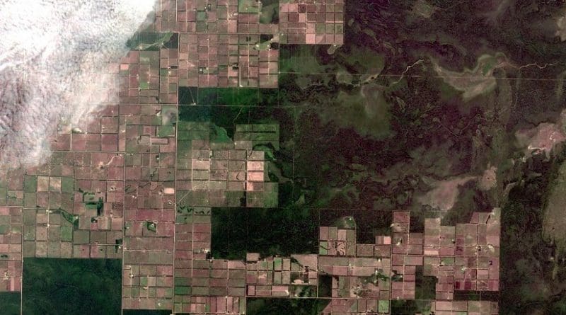
The newly published analysis reveals that clearings for large-scale agricultural expansion were responsible for an increasing proportion — in some places, more than half — of all observed forest loss across the tropics between 2000 and 2012.
The trend was most pronounced in Southeast Asia and South America.
“In South America, more than 60 percent of the increase in deforestation was due to a growing number of medium- and large-sized forest clearings typical of what you see with industrial-scale commercial agricultural activities,” said Jennifer J. Swenson, associate professor of the practice of geospatial analysis at Duke’s Nicholas School of the Environment.
“Brazil, which had stricter policies limiting agricultural expansion until 2012, was the only country showing a reverse trend — its average forest clearing size actually got smaller,” she said. “This unique trend may be short-lived, however, given Brazil’s relaxed forest policies of the last few years.”
The new findings underscore the growing need for policy interventions that target industrial-scale agricultural commodity producers in the tropics, the researchers say.
A small family farm that produces sustenance crops or food for local consumption typically causes less than 10 hectares — or just under 25 acres — of land to be cleared per year, said Ph.D. student Kemen G. Austin, who co-authored the report. These small clearings can have relatively modest impacts on biodiversity, habitat connectivity, carbon storage, water quality, erosion control and other vital ecosystem services the forest provides.
By comparison, an industrial-scale plantation — such as one that grows and processes palm oil or soybeans for the global market — can cause nearly 2,500 acres of land to be cleared annually.
“As the size of the cleared land increases, so do the scale and scope of the potential ecological impacts,” explained Ph.D. student Danica Schaffer-Smith.
The Duke team conducted their analysis using high-resolution, satellite-derived maps of forest cover produced by researchers at the University of Maryland.
“Using these invaluable maps, we were able to design a new computational approach that allowed us to analyze trends in clearing sizes across the globe,” said Schwantes, who programmed the computational analysis with González-Roglich.