
China’s Maritime Intelligence, Surveillance And Reconnaissance Capability In South China Sea – Analysis
By Published by the Foreign Policy Research Institute
By Felix K. Chang*
(FPRI) — Detecting, identifying, and tracking ships at sea are among the most fundamental intelligence, surveillance, and reconnaissance (ISR) tasks that any country must perform if it wants to exert control over a maritime area—a goal China has long sought to achieve in the waters off its eastern seaboard. So, it is hardly surprising that China, especially after the early 2010s, has significantly boosted its ISR capabilities in those waters, and none more so than in the South China Sea.
Certainly, considerably less escapes China’s notice in the South China Sea today than in the past, judging by how much faster Chinese maritime forces react to events there. Given reasonably good ISR data on a ship’s position, course, and speed, Chinese naval or coast guard vessels patrolling the area can now be expected to intercept it without much trouble. That ability has already helped Beijing better assert its sovereignty over the waters within its self-proclaimed “nine-dash line” in the South China Sea. But Beijing has not stopped there. It continues to heavily invest in ever more precise and timelier ISR collection assets in the area, leading one to wonder whether China’s real intention is to develop an ISR network capable of targeting ships far out to sea. Such a network could enable China to defend the region with long-range guided weapons and perhaps even create a naval bastion for its sea-based nuclear deterrent.
Chinese ISR Collection Assets
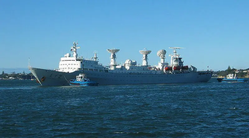
The ISR collection assets that China has assembled in the South China Sea span a wide range of technologies. Each holds certain advantages and disadvantages. If properly woven together into a robust network, they offer Chinese commanders an increasingly accurate and persistent picture of maritime activity in the area.
High-frequency direction finding. Of all the ISR technologies that China employs, high-frequency direction finding (HF/DF) has probably been in use the longest.[1] By collecting electronic emissions from a ship, an HF/DF site can assess a line of bearing to it. With lines of bearing from at least two suitably spaced HF/DF sites, they can then estimate that ship’s position with reasonable accuracy. Generally, the more HF/DF sites there are and the closer they are to their intended target, the better their estimates will be. That is why satellite imagery from 2018 revealing a new HF/DF site on Chinese-occupied Mischief Reef in the Spratly archipelago was notable.[2] If operational, the site would undoubtedly improve China’s HF/DF collection in the region.
Still, HF/DF accuracy has its limits, considering the technology’s dependence on atmospheric conditions, which tend to vary. The South China Sea’s highly turbulent weather during the summer and fall would compound its collection challenge. Moreover, the large number of electronic emissions from cellular telephone networks, commercial land-based transmitters, and civilian aircraft and ships all around the South China Sea would make it even more difficult for HF/DF sites to segregate and identify the emissions from a particular ship of interest.
Satellites. Given the limitations of HF/DF technology, China has understandably sought to strengthen its maritime ISR with satellites. Of course, not all satellites are equally capable. Even apart from differences in onboard sensors, the orbits of satellites have a big impact on how useful they are. Geostationary satellites are designed to “hover” over the earth and thus are useful for continuous monitoring of a specific area. On the other hand, they can only do so at very high altitudes of 36,000 km, reducing the fidelity of the data they can collect. In contrast, satellites orbiting the earth at relatively low altitudes can collect far more accurate data. Because they must circle the earth, they only spend a brief time over an area, leaving big gaps in their collection.
For China to collect ISR data accurate enough for weapons guidance, it would have to operate satellites from low-earth orbit. To gain the sort of persistent ISR coverage that would be needed to target moving ships, China would need a constellation of multiple satellites. And that is apparently what China has sought to create. Between 2017 and 2019, China put at least 15 ISR satellites into low-earth orbit. The last three were placed at 600 km above the earth at an orbital inclination of 35 degrees, well-suited to monitoring the tropics.[3] No doubt, China’s new satellite constellation has reduced the gaps between observations. While not publicly known, some of its satellites likely cover the South China Sea.
Possibly augmenting its space-based ISR above the region, China launched the first of ten remote-sensing satellites in 2019. They are part of what China calls its Hainan Satellite Constellation project, which is designed to “maintain uninterrupted observation” of the South China Sea. While the satellites are nominally under the civilian control of the Chinese Academy of Sciences’ Institute of Remote Sensing and Digital Earth, the data that it collects are likely to have dual-use applications. At the very least, the data will give China an understanding of the normal patterns of maritime activity (not to mention electronic emissions) in the region. The constellation’s remaining satellites are slated to be in orbit by the mid-2020s.[4]
Land-based radar. China also has at its disposal a large number of terrestrial radars. Indeed, radar is the principal all-weather means to perform wide-area surveillance; and China has one of the largest radar networks in the world. China has even built massive over-the-horizon backscatter (OTH-B) radar sites, which use the ionosphere and the surface of the sea, to detect aircraft and ships thousands of kilometers away. In 2004, China bought its first such OTH-B radar from Russia.[5] Like older HF/DF technology, such radars can be beneficial for long-range detection and identification. Due to their use of long radar wavelengths, their precision is limited, as sensor performance suffers from adverse propagation effects. Plus, they are subject to the vagaries in the ionosphere and sea state.
Coastal radars are much more helpful for reliable tracking and targeting of ships at sea, but most have a difficult time reliably peering beyond 200 to 250 km offshore. Hence, it was no surprise that China announced plans to further expand its coastal radar network in 2014. Nor was it surprising that among the first facilities that China built on its artificial islands in the Spratly archipelago were radars, given their distance from the Chinese mainland. Radars surely give China more persistent and precise situational awareness in the South China Sea. Even so, the region’s waters are expansive, and big coverage gaps remain between China’s land-based radar sites.
Sea-based radar. One way to close those coverage gaps would be to build radar sites on the sea. And that is what China set about doing in 2016. It began construction on its “Blue Ocean Information Network,” an array of radars built on unmanned semi-submersible platforms around the South China Sea. Designed to either float in deeper waters or be moored in shallower waters, each platform stands between 10 to 20 meters above the water and has a surface area of about 250 to 300 square meters. As of 2020, five such platforms have been constructed around Hainan Island and one near the Paracel Islands.
According to the Chinese journal Electronic Science & Technology, China plans to expand the “Blue Ocean Information Network” in “key maritime areas of [Chinese] jurisdiction” and start full construction of the marine network by 2025. The network is designed to “meet the urgent needs of military and civilian authorities for the acquisition of information in China’s jurisdictional maritime areas.” Naturally, that is likely to raise concerns among China’s neighbors, considering the ease with which the Chinese military could access the data from the network’s radars. In addition, depending on their power output, the radars could be used for not only detection, identification, and tracking, but also for the targeting of ships at sea. Adding to such concerns, the Chinese military’s China Military Online website characterized the platforms as a “new system to defend islands and reefs in the South China Sea” in 2019.[6]
Air-based radar. As recently as the early 2010s, China’s airborne ISR over the South China Sea was still rudimentary, largely consisting of long-range patrols by Chinese H-6 bombers using their onboard surveillance radars rather than more powerful ones found on dedicated airborne early warning (AEW) aircraft. By the mid-2010s, however, China had swapped out the H-6 bomber with the KJ-200, China’s first entirely domestically built AEW aircraft, on those patrols. More recently, China has begun to replace the KJ-200 with the KJ-500, its latest AEW aircraft, which is fitted with an improved phased-array radar capable of simultaneously tracking 60-100 airborne targets out to 470 km.
In 2017, the first KJ-500 AEW aircraft appeared at Lingshui naval air base on Hainan Island.[7] In May 2020, China even dispatched a KJ-500 to the airstrip on Chinese-controlled Fiery Cross Reef in the Spratly archipelago. And then, in December 2020, satellite imagery spotted five KJ-500s on Lingshui’s aircraft apron. Given that China is currently estimated to have only 15 KJ-500s in its entire inventory (and its naval air force has only seven of those), the presence of five KJ-500s at a single naval air base is noteworthy.[8] If all of them are permanently stationed there, then China could maintain at least one KJ-500 over the South China Sea at all times.
Beyond its manned platforms, China has deployed a number of ISR-capable unmanned aerial vehicles (UAV). Of course, the payloads of such UAVs are far smaller than those of AEW aircraft, which means that their radars are likely to be less powerful and, thus, have shorter detection ranges. Nevertheless, their ability to loiter overhead for long stretches allows them to conduct what is called “persistent surveillance.” If employed at the right places and times, they can fill gaps in AEW or satellite coverage over the South China Sea.
Certainly, China has ploughed significant resources into the development of UAVs since the early 2000s. Though it is unclear how many ISR UAVs China currently has in service, a few have been spotted at Lingshui naval air base since 2016. These included three BZK-005 and two WZ-7 (“Soar Dragon”) high-altitude long-endurance reconnaissance UAVs.[9] Satellite imagery also revealed a BZK-005 on Woody Island in the Paracel archipelago. And, in 2018, Japan’s report of a BZK-005 patrolling above the East China Sea seemed to confirm that China had begun to use such UAVs for maritime ISR.[10]
To What Ends?
Without question, China has dramatically improved its maritime ISR capability in the South China Sea in terms of not only the number and variety of its collection assets, but also their quality. China’s high concentration of ISR collection assets clearly reflects the importance that Beijing places on the area. It also demonstrates the scale of resources that Beijing is willing to devote to monitoring the waters it claims. No doubt, China’s growing maritime ISR capability has enabled it to better assert its sovereignty over much of the South China Sea, not to mention keep tabs on the activities of its Southeast Asian neighbors. But the sheer volume of collection assets that China is amassing seems out of proportion for such missions.
The fact that China continues to deploy new and ever costlier ISR collection assets, such as radars on semi-submersible platforms on the sea, suggests that other reasons may be at play.
One of them might be a desire to create a heavily defended area where China’s new Type 094 (or Jin-class) nuclear-powered ballistic missile submarines, which are based at Yalong Bay on the northern edge of the South China Sea, can operate in safety—much as the Soviet Union did for its sea-based nuclear forces in the Barents Sea and the Sea of Okhotsk during the Cold War. If so, China would seek to defend such a naval bastion with its most advanced weapons, including anti-ship ballistic missiles. And for those to be effective, they would need the sort of precise tracking and targeting data that a robust ISR network could provide. Whether or not a naval bastion is China’s ultimate purpose, it seems apparent that China is assembling the elements for an ISR network capable of supporting one.
The views expressed in this article are those of the author alone and do not necessarily reflect the position of the Foreign Policy Research Institute, a non-partisan organization that seeks to publish well-argued, policy-oriented articles on American foreign policy and national security priorities.
*About the author: Felix K. Chang is a senior fellow at the Foreign Policy Research Institute. He is also the Chief Operating Officer of DecisionQ, a predictive analytics company, and an assistant professor at the Uniformed Services University of the Health Sciences.
Source: This article was published by FPRI
[1] Kevin Pollpeter, “Towards an Integrative C4ISR System: Informatization and Joint Operations in the People’s Liberation Army,” in The PLA at Home and Abroad: Assessing the Operational Capabilities of China’s Military, eds., Roy Kamphausen, David Lai, and Andrew Scobell (Carlisle, PA: Strategic Studies Institute, Jun. 2010), pp. 219–226.
[2] J. Michael Dahm, Introduction to South China Sea Military Capability Studies, South China Sea Military, South China Sea Military Capability Series: A Survey of Technologies and Capabilities on China’s Military Outposts in the South China Sea (Baltimore: Johns Hopkins University Applied Physics Laboratory, Jul. 2020), p. 14.
[3] Andrew Tate, “China launches more surveillance satellites,” Jane’s Defence Weekly, Jul. 29, 2019.
[4] Andrew Tate, “China initiates satellite project to enable ‘uninterrupted observations of South China Sea,’” Jane’s Defence Weekly, Jan. 4, 2018.
[5] Norman Friedman, “China Purchases Russian Radars,” Proceedings, Dec. 2005, p. 90.
[6] Andrew Tate, “China enhancing South China Sea surveillance capabilities,” Jane’s Defence Weekly, Apr. 9, 2019.
[7] A U.S. Navy EP-3E reconnaissance aircraft was forced to land at Lingshui air base in April 2001 after a Chinese fighter collided with it during a close pass. The EP-3E’s 24 crew members were detained for ten days before being released.
[8] “China – Navy,” Jane’s World Navies, updated Feb. 12, 2020; and “China – Air Force,” Jane’s World Air Forces, updated Feb. 3, 2020.
[9] Sean O’Connor, “Spaceshot: Chinese UAV gathering reveals unusual object – 42.196365 N 087.162109 E,” Jane’s Defence Weekly, Aug. 14, 2018; “Xianglong UAVs spotted on China’s Hainan Island,” Jane’s Defence Weekly, Mar. 2, 2018, http://www.janes.com/article/78751/xianglong-uavs-spotted-on-china-s-hainan-island; and Vinayak Bhat, “Satellite images reveal China’s state-of-the-art naval airbase,” ThePrint, Oct. 17, 2017, https://theprint.in/report/satellite-images-reveal-china-naval-airbase/12740/.
[10] Japan Ministry of Defense, Defense of Japan 2020, p. 71.