
Detecting Forest Fragility With Satellites
Over the past decades forests in different parts of the world have suffered sudden massive tree mortality. Now an international team of scientists led by researchers from Wageningen University in the Netherlands have found a way to spot from satellite images which forests may be most likely to fall prey to such die-off events.
Tree cover is one of the most defining aspects of landscapes, said Jan Verbesselt, lead-author and a specialist in remote sensing.
“It is therefore remarkable how poorly we can predict where trees are most likely to succumb to drought and other stresses. However, our planet is permanently monitored by satellites in detail, and we are proposing a new way to use that information for detecting the fragility of ecosystems to environmental perturbations,” Verbesselt said.
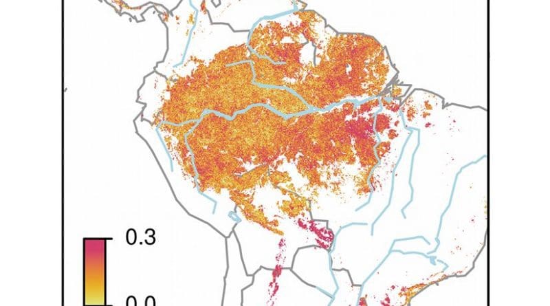
For the first time researchers were able to derive evidence for such changes from long-term satellite time series observations of tropical forests.
According to Martin Herold, “Global satellite archives are getting longer and denser every day. Together with free and open archived data, this provides a rich source of information that only now is starting to be used for tropical forest resilience analysis over large areas and increasing time spans.”
Slow recovering
“The basic idea is simple,” said Marten Scheffer, who leads the research program on resilience of complex systems. “As a system loses resilience it becomes slower to recover from small perturbations. This also happens as a system approaches a tipping point. Now we found that the natural fluctuation in greenness of forests, as driven by weather changes, may actually reflect such slowness. This is the first time, we are able to generate indicators that can anticipate the fragility of forests to future climate changes and disturbances”.