
The Role Of Satellites In Maritime Domain Awareness In India – Analysis
By Sirat Bhalla
Oceans are vulnerable to threats ranging from environmental destruction to terrorism which necessitates the security of maritime assets. Oceans being fluid constantly change making it impossible to track the elements of an oceanic system and here space technology proves to be of great use. The invention of satellites has enhanced the capabilities to collect and utilise the data from oceans with fair accuracy and efficiency.
India entered the space race in the 1970s and since then it has successfully launched multiple Low Earth Orbit (LEO), Medium Earth Orbit (MEO), High Earth Orbit (HEO) and Geostationary Earth Orbit (GEO) satellites.
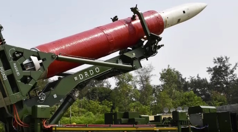
On March 27, 2019 India acquired the capability of Anti-Satellite (ASAT) weapon after the successful implementation of the Mission Shakti program that was led by the Defence Research and Development Organisation (DRDO) and the Indian Space Research Organisation (ISRO). After shooting down Microsat-R, an Indian LEO satellite, in just three minutes, India became the fourth country with this state-of-the-art technology. However, India stands against the arms race in space with a belief that space must be used for peaceful purposes as it is the common heritage of humankind. India has said that it will militarize space only for defensive purposes.1
India only has one exclusive defense satellite, Rukmani, of which the Indian Navy is the user. In 2013, GSAT-7 Rukmani, a multi-band military communication satellite, was launched and was capable of monitoring Indian Ocean Region (IOR) spread across 2,000 nautical miles. This geostationary naval satellite provides real-time data to Indian Navy ships and submarines.2 It performed tremendously well by providing network capabilities during the Theatre-level Readiness and Operational Exercise (TROPEX),3 and it also supported Indian Naval Units involved in the search and rescue operation of the infamous Boeing 777-200 aircraft. 4
To replace Rukmani, the Indian Navy on June 11, 2019, placed an order to ISRO for building a new GSAT-7 repeat or GSAT-7R.5
Maritime Domain Awareness (MDA) is crucial for maritime security as without understanding maritime domain one cannot protect it from innumerable threats. The extraction and accumulation of intelligence in real-time and ensuring that it reaches the desired destination in real-time require communication, surveillance and navigation, which are only possible using satellites.6 Thus the best option is to develop a space-based MDA architecture. Currently, two recent developments Automatic Identification System (AIS) and Synthetic Aperture Radar (SAR) are very important for MDA.
The initial motivation behind the development of AIS was to avoid collision between vessels, but it had limitations, for instance, the Very High Frequency (VHF) range was of just 10-20 nautical miles7 and ships could turn off the AIS when they didn’t want to get detected and identified.8
Satellites were seen as the solution to these challenges as the view from space is different covering a larger area. The Satellite Automatic Identification System (S-AIS) was developed as a result. S-AIS now not only focuses on the prevention of vessel collisions, but also provides protection by alerting maritime security forces of purposeful violation occurrences of maritime boundaries. It is also being used by states to manage and control maritime traffic and helps with navigation using a special application called AIS Aids and Navigation (A to N), which further helps in search and rescue operations.9
When S-AIS is applied innovatively it can help authorities to identify any potential threat, which eventually aids the improvement of MDA leading to heightened security. But even S-AIS faces a challenge: serving many AIS cells simultaneously leads to a collision of messages making it difficult to decode them. This needs to be addressed possibly by using the technique based on Blind Source Separation (BSS). To enhance S-AIS system these five factors must be taken care of: (a) continuous global coverage and superior detection rates, (b) real-time downlinks, (c) ability to detect all AIS broadcasters, (d) ability to handle rapidly expanding Application Specific Messages (ASM), and (e) ability to adapt to evolving uses of the maritime VHF Spectrum.10
India doesn’t have an S-AIS system of its own, but plans for it are underway. In 2019, India and France formalized around 10 LEO satellites having space-based AIS technology to monitor vessels in the Indian Ocean.11 India is currently using exactEarth of Canada. exactEarth signed a contract in 2016 with Antrix Corporation Ltd., the commercial arm of ISRO to provide S-AIS data services to the Indian Navy.12
Apart from S-AIS another major requirement for MDA is of Synthetic Aperture Radar (SAR) satellites. SAR imaging sensors can work during day and night, including bad weather condition. The images that are generated can be used for applications such as ship detection, monitoring of sea ice, wave and wind retrievals, as well as interpreting surface current gradients’ signatures over oceanic fronts, internal waves, and shallow water bathymetry. SAR satellites are also suitable for oil spill monitoring.13
SAR, though very useful, has certain limitations attached to it; the issues are related to application, data access and data dissemination. Interpretation of signal intensity and the phase difference is vital for exploring SAR data, but it demands complex processing techniques that can be automated; automation of Electro-Optical (EO) imagery is available and when used with SAR, proves to be beneficial for users. Thus, it raises the demand for SAR and Optical fusion. Since there is a plethora of data, availability does not equal accessibility — therefore defence must take steps to leverage the processing and analytics capabilities required to exploit the complex SAR data by employing enterprise computing.
India has two SAR satellites, RISAT 1 and 2, which possess submarine-detecting capability. Yet, their resolution is not sufficient and efficient enough to provide the necessary detection capabilities, particularly when compared to their Chinese counterparts. India will need a larger number of radar satellites in the coming years.14
India has been taking steps to improve its MDA. The government has plans to establish a National Maritime Authority (NMA) that will help with policy-making and coastal security coordination among the stakeholders.15 It is also focusing on the development of National Maritime Domain Awareness (NMDA) under which Indian Navy has established the National Command Control Communication Intelligence (NC3I) network that hosts Information Management and Analysis Centre (IMAC). IMAC has an Information Fusion Centre (IFC) that collects, fuses and disseminates intelligence information received from multiple sources.16 India intends to buttress the NMDA by initiating multilateral cooperation agreements.
The country has set maritime security as its foremost agenda and it’s conspicuous for its involvement in defense meetings of the Indian Ocean Rim Association (IORA), East Asia Summit and ASEAN. In addition, Prime Minister Narendra Modi’s recent visits to the Maldives, Seychelles and Sri Lanka had top priority given to maritime security concerns.
The National Automatic Identification system (NAIS) network has successfully been implemented in India providing it with an AIS maritime picture over the entire Indian coastline. It involves both the Indian Navy and Coast Guards.17 India, however, should extend its cover beyond IOR to the South China Sea and Western Pacific Ocean.
India needs to transform ‘Make in India’ and become ‘Aatma Nirbhar’; while foreign defense companies are ready to collaborate with Indian ones, they are hesitant to transfer cutting-edge technology. Equally worrisome is Indian companies’ atrocious capacity to acquire and absorb foreign technology.
S-AIS and SAR satellites by themselves are neither reliable nor capable in providing relevant information for MDA, therefore it is crucial to deploy multiple sources. The big data collected from these sources need fusion and decision-making support. It is true that collaboration of this data at a global level would allow the watch centres around the world to get a better understanding of what is happening in their respective area of concern and where it fits in the global picture. Collaborative Space- based Maritime Situational Awareness (C-SIGMA) is an initiative towards the accomplishment of Global Maritime Awareness.
To conclude, space-based technology will not replace the terrestrial systems in the future, rather they will make the terrestrial systems more efficient. For instance, in the future instead of sending an area patrol to search, they will be sent directly to the area where the abnormal activity is known to be occurring. Many countries are looking to space to enhance their national security by strengthening their military capabilities. Today they are developing their own space capabilities to close the knowledge gap of what is going on in the oceans.
*Sirat Bhalla is a Research Student at Janki Devi Memorial College, Delhi, India. The views expressed in this essay are the author’s own. She can be reached at [email protected]
Notes:
- Mea.gov.in. (2019). Speech by Prime Minister on ”Mission Shakti”, India’s Anti-Satellite Missile test conducted on 27 March, 2019. [online] Available at: https://www.mea.gov.in/Speeches- Statements.htm?dtl/31180/Speech+by+Prime+Minister+on+Mission+Shakti+Indias+AntiSatellite+Miss ile+test+conducted+on+27+March+2019
- Isro.gov.in. (2013). GSAT-7 – ISRO. [online] Available at: https://www.isro.gov.in/Spacecraft/gsat-7
- Pandit, R. (2014). Tropex: Navy validates massive exercise under country’s first military satellite’s gaze | India News – Times of India. [online] The Times of India. Available at: https://timesofindia.indiatimes.com/india/Navy-validates-massive-exercise-under-countrys-first- military-satellites-gaze/articleshow/31225807.cms
- Gupta, J. (2014). Indian Navy joins search for missing Malaysian plane in the Malacca Straits. [online] The Economic Times. Available at: https://economictimes.indiatimes.com/news/politics-and-nation/indian- navy-joins-search-for-missing-malaysian-plane-in-the-malacca-
- Pubby, M. (2019). Navy to buy Rs 1,589 crore satellite from ISRO. [online] The Economic Times. Available at: https://economictimes.indiatimes.com/news/defence/navy-to-buy-rs-1589-crore-satellite- from-isro/articleshow/70283927.cms?from=mdr
- Lele, A. (2017). Space and Maritime Security. New Delhi: National Maritime Foundation.
- Ibid.
- Oceana. (2018). Avoiding Detection: Global Case Studies of Possible AIS Avoidance. [online] Available at: https://oceana.org/publications/reports/avoiding-detection-global-case-studies-possible-ais-avoidance
- Lele, A. (2017). Space and Maritime Security. New Delhi: National Maritime Foundation.
- Ibid.
- Mea.gov.in. (2018). India-France Joint Vision for Space Cooperation (New Delhi, 10 March 2018). [online] Available at: https://mea.gov.in/bilateral- documents.htm?dtl/29597/IndiaFrance+Joint+Vision+for+Space+Cooperation+New+Delhi+10+March
- Exactearth.com. (2016). exactEarth to Provide India’s Navy with Satellite AIS. [online] Available at: https://www.exactearth.com/media-centre/recent-news/340-exactearth-to-provide-india-s-navy-with- satellite-ais
- Lele, A. (2017). Space and Maritime Security. New Delhi: National Maritime Foundation.
- Bommakanti, K. (2018). India and China’s space and naval capabilities: A comparative analysis | ORF. [online] ORF. Available at: https://www.orfonline.org/research/42694-india-and-chinas-space-and- naval-capabilities-a-comparative-analysis/
- Pandit, R. (2014). Apex maritime authority for coastal security. [online] The Economic Times. Available at: https://economictimes.indiatimes.com/news/politics-and-nation/Apex-maritime-authority-for- coastal-security/articleshow/36342504.cms
- Nmio.ise.gov. (2013). [online] Available at: http://nmio.ise.gov/Portals/16/Docs/National_MDA_Plan_NMDAP-20131216_Final.pdf?ver=2015-12-
- https://saabgroup.com/media/news-press/news/2012-08/saab-implements-national-automatic-identification-system-nais-for-indias-coastline-safety–security/
Nice article. Well researched. I enjoyed reading it.
Recommend it to all interested in maritime security and safety.
The comment at the end is very important as many have been denegrated space-based maritime domain awareness since it was first proposed in late 2001, saying it cannot do it a. Indeed it cannot, but it can make the terrestrial systems much more efficient and effective.
19 years ago we were worried about the costs. Now those have come down enough for it to be clear space systems are well worth the price.