History Of Earthquakes In Central Virginia Seismic Zone
Since at least 1774, people in central Virginia have felt small earthquakes and suffered damage from infrequent larger ones, according to the U.S. Geological Survey (USGS), which notes on its website that the largest damaging earthquake (magnitude 4.8) in the seismic zone occurred in 1875.
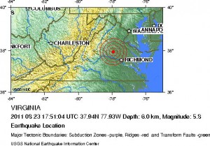
According to reports, the earthquake that hit central Virginia Tuesday was a 5.8-magnitude, and was at a depth of 6 km (3.7 miles).

With respect to the wide-range in which the earthquake was felt, the USGS website explains that earthquakes in the central and eastern U.S., although less frequent than in the western U.S., are typically felt over a much broader region. East of the Rockies, an earthquake can be felt over an area as much as ten times larger than a similar magnitude earthquake on the west coast.
“A magnitude 4.0 eastern U.S. earthquake typically can be felt at many places as far as 100 km (60 mi) from where it occurred, and it infrequently causes damage near its source. A magnitude 5.5 eastern U.S. earthquake usually can be felt as far as 500 km (300 mi) from where it occurred, and sometimes causes damage as far away as 40 km (25 mi),” according to the website.
