
Guyana’s Sovereignty Over The Cuyuni River – Analysis
By COHA
By Dr. Odeen Ishmael*
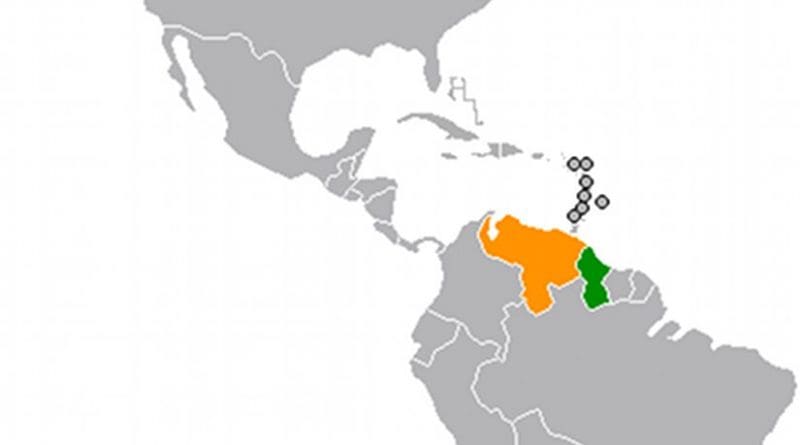
In September 2015 Venezuela flexed its military muscle near the border with Guyana: Its military patrol boats openly breached Guyana’s sovereignty by crossing the Cuyuni River at several locations between the river’s junctions with the Acarabisi and Wenamu rivers, some eighty river-miles apart. Guyana claims to own this entire section of the Cuyuni, which forms part of its border with Venezuela.
On September 23, the head of the Guyana Defense Force (GDF), Brigadier Mark Phillips, confirmed that the Venezuelans were using military boats in the Cuyuni River to shuttle troops between the village of San Martin on the northern bank to the Venezuelan-occupied Guyanese section of Ankoko Island. He termed this action “an affront to our sovereignty.”
While it is normal practice for Venezuelan civilians residing on the northern bank of the Cuyuni to use the river for basic transportation and domestic purposes, international law allows Venezuelan military forces to enter the river east of the Wenamu only with the Guyana government’s permission.
Venezuela has flouted this requirement, and over the years its military patrol boats have used the river as if it was part of Venezuela.
The boundary line
It is worth remembering that Guyana’s boundary with Venezuela was clearly defined by an international arbitration tribunal in 1899 as follows:
“. . . Starting from the coast at Point Playa, the line of boundary shall run in a straight line to the River Barima at its junction with the River Mururuma, and thence along the midstream of the latter river to its source, and from that point to the junction of the River Haiowa with the Amacura, and thence along the mid-stream of the Amacura to its source in the Imataka Ridge, and thence in a south-westerly direction along the highest ridge of the spur of the Imataka Mountains to the highest point of the main range of such Imataka Mountains opposite to the source of the Barima, and thence along the main ridge in a south-easterly direction of the Imataka Mountains to the source of the Acarabisi, and thence along the mid-stream of the Acarabisi to the Cuyuni, and thence along the northern bank of the River Cuyuni west-ward to its junction with the Wenamu, and thence along the mid-stream of the Wenamu to its westernmost source, and thence in a direct line to the summit of Mount Roraima . . .”
Guyana’s eastern half of Ankoko Island
Despite the clear demarcation of the border, this line of division was deliberately breached by armed Venezuelan military forces during the uprising in Bolivar State in the early 1960s when armed Venezuelans were deployed in the effort to capture guerrillas who, when pursued, would attempt to escape across the Cuyuni River into forested Guyanese territory.
The absence of Guyanese policing in the area aided in the non-detection of such military activities by Venezuelan authorities, who eventually encroached on Guyanese territory on the eastern part of the roughly three-square-mile Ankoko Island at the junction of the Cuyuni and the Wenamu rivers. This gradual occupation began when Venezuelan civilians began to move over to the Guyanese side, but it was only discovered by Guyanese authorities in September 1966. By this time the Venezuelan military had already constructed an airport runway and barracks on Guyanese territory. When Guyana issued a diplomatic protest, Venezuela adamantly refused to retreat and insisted that the entire island was part of its territorial domain.
In a significant diplomatic blunder, the Guyanese government refused to officially inform the UN Security Council of this alleged Venezuelan aggression against its neighbors. It again refused to do when Venezuelan President Raul Leoni in July 1968 issued a decree appropriating a twelve-mile strip of Guyana’s offshore waters parallel to the Essequibo coast.
Meanwhile, discussions between the two governments failed to remove the Venezuelans from Guyana’s part of Ankoko. Discussions continued during the preparation of the Protocol of Port of Spain of June 1970. At the time, according to Guyanese Minister of State Shridath Ramphal, the Venezuelans contended that their claim to the eastern half of the island was based not so much on their contention of the nullity of the arbitral award of 1899, but on their occupation and use over the years. As he stated in a letter of June 6, 1970, to Guyana’s ambassador in Washington, Rahman Gajraj,
“They make it clear to us that politically they cannot withdraw from the eastern half of the island at this stage and the result is a live and let live arrangement. We have made it clear that we shall continue to demand their withdrawal and that the Protocol in no way inhibits us from doing so. They understand this.”
But despite all of Guyana’s protests and demands, Venezuela has since firmly embedded itself on this portion of Guyana’s territory.
Back in 1904 (when Guyana was still the territory known as British Guiana), Venezuelan and British boundary commissioners connected the boundary from the north bank of the Cuyuni to the midstream of the Wenamu by drawing a line through Ankoko, dividing the island from north to south in roughly equal parts; the eastern part fell on the British Guiana side of the boundary and the western part on the Venezuelan side. A boundary map showing these details was signed on January 7, 1905, by boundary commissioners Harry Innis Perkins and Charles Wilgress Anderson of Great Britain and Abraham Tirado and Elias Zoro of Venezuela.
In addition to showing the authenticity of the boundary on the map, the commissioners wrote an account of how they established the boundary line across the island and marked it on the ground. Perkins, the senior British boundary commissioner, made the following statement in the official report of the work of the boundary commission submitted on the January 9, 1905, to the Government Secretary of British Guiana and published it in the public records of British Guiana for that year:
“. . . At the Wenamu mouth we verified our astronomical work of the previous May, and fixed the course of the boundary line from a point on a large island called Anacoco opposite the midstream of the Wenamu to a point on the other side of the same island, and from thence to a point on the mainland on the left bank of the Cuyuni where the Colony’s boundary continues to the Acarabisi, etc. We marked the points by driving posts of bullet tree some six feet in length into the ground, and surrounding each with a pyramid of stone collected from the river bed, and carefully packed around them. These should last for many years if not for ever. A line had previously been cut and surveyed across the island by me during our work on the Cuyuni earlier in the year, and this was made use of to determine the boundaries of the boundary marks.”
Ever since the completion of the boundary commission’s work, the eastern part of Ankoko was recognized as juridically and administratively part of Guyana and totally within its boundaries. Before 1966 the Venezuelan government had never challenged the validity or accuracy of the map produced by the boundary commissioners and had at no time asserted sovereignty over the entire island of Ankoko. The 1966 Geneva Agreement and the discussions leading up to it concerned the sole issue of whether the arbitral award of 1899 was null and void; Venezuela lodged no challenge to the accuracy with which the boundary line as shown on the 1905 map reflected the terms of the award.
Venezuelan activity in the Cuyuni River
From 1966 onward, Venezuela committed a series of aggressions directed at the command and control of Guyana over its rightful territory. All of the numerous islands in the Cuyuni River, along with the river itself, from where the Wenamu flows into the Cuyuni River to where the Cuyuni forms a confluence with the Mazaruni and flows into the Essequibo, represent sovereign territory amounting to 83,000 square miles of Guyana. Large circular wooden signs painted in the colors of the national flag were placed on every island between the mouth of the Wenamu to Acarabisi some eighty miles downriver. But over the years, Venezuelans encroached on those islands, destroyed the signs, and took control of several small islands between the Wenamu and Acarabisi to farm, cut timber and reside. These actions, from time to time, were met with firm rejection by Guyanese soldiers positioned in the area, and fortunately there was no confrontation. Venezuelan infringement of Guyana’s territorial space was brought to the Venezuelan government’s attention through diplomatic channels. Many of these occurrences were also emphasized by the GDF veteran, Keith Williams, in a letter published in the Stabroek News on September 17, 2013.
Nevertheless, Venezuelans continue to use this stretch of the Cuyuni as if it is their waterway. Actually, some years ago Guyanese miners in the area reported that when traveling on the river they flew the Venezuelan flag so as not to be harassed by Venezuela’s National Guard or regular army units.
So far, the GDF forces stationed at Eteringbang, (opposite Ankoko Island) do not seem to be ready to confront the Venezuelan military who continue to brazenly treat the river as if it is Venezuelan property. (The Venezuelan settlement of San Martin lies on the northern bank of the Cuyuni across from Eteringbang.) In an editorial on December 14, 2014, the Stabroek News expressed grave concern that Guyanese police and other security forces in the area, and even some members of the legal profession, were totally ignorant of the fact that Guyanese sovereign territory included the eastern part of Ankoko Island as well as the Cuyuni River east of the Wenamu River.
Proposals for military cooperation on the border
The heightening of military tension in the border region may be due to the fact that there is not any active line of communication between the militaries of Venezuela and Guyana. Attempts were made by both governments in 1990 to develop some form of cooperation with respect to border security; discussions took place between the armed forces of the two countries at Tumeremo (in Bolivar State), resulting in a visit of the commander of the Venezuelan army to Georgetown later that year. Following his meetings with the GDF leadership, agreement was signed for collaboration in training, sports and culture between the military forces of both countries. But not much consequence arose out of that agreement.
In April 1996, a Venezuelan military delegation visited Guyana and again discussed measures to cooperate with the GDF leadership. This meeting was a continuation of the wide-ranging collaboration in which Guyana was involved with its three border countries (Venezuela, Brazil and Suriname). The Guyana side proposed the appointments of army officers as military attachés—positions that were apparently vacant for some time—to their respective embassies in a move to deepen the relationship between the defense forces. (It wasn’t until 2005 that Guyana appointed a non-resident military attaché to its embassy in Caracas.)
A further statement of cooperation emanated in late February 2002 during the High-Level Bilateral Commission meeting in Guyana when Venezuelan Foreign Minister Luis Alfonso Davila announced his country’s offer of cooperation between the military forces of Guyana and Venezuela to strengthen links against the trafficking of drugs. He said Venezuela was willing to offer cooperation in training, intelligence and other areas so that the two armed forces could work cooperatively. Guyanese Foreign Minister Rudolph Insanally welcomed this offer and noted that Guyana was already taking advantage of courses given at one of the universities in Venezuela, specializing in maritime affairs. The Venezuelan offer, he added, would create an atmosphere of mutual trust and confidence necessary for building cooperation and eliminating differences between the two countries.
But such positive expression did not produce all the expected cooperation. Four years later, in October 2006, a Guyanese citizen was shot dead on Guyana’s territory at Eteringbang on the Cuyuni River by members of the Venezuelan military. There was no formal admission of this by the Venezuelan authorities, who did announce that they arrested four army personnel in relation to the shooting, only to release the four soon after.
One year later, in November 2007, Venezuelan military forces destroyed Guyanese-owned dredges moored on the Cuyuni River which the Venezuelan authorities, in response to Guyana’s protest, claimed as Venezuelan territory. However, Venezuela backtracked on this claim when on December 11, 2007, Vice-Minister of Foreign Affairs Rodolfo Sanz met with President Bharrat Jagdeo and Insanally in Georgetown and expressed his country’s regrets about the incursion into Guyana’s territory. He said the destruction of the Guyanese dredges had no political motive on the part of the Venezuelan government, but he intimated that the acts were done as a result of a campaign the Venezuelan military was carrying out to preserve the immediate environment in the border region. To avoid similar occurrences in the future, the two sides agreed to create bilateral mechanisms to address the issue of mutual concern. But Sanz’s statement fell short of explaining what gave the Venezuelan military any right to carry out such activities on Guyana’s territory.
In response, Insanally said the destruction of the dredges in the Cuyuni River raised concerns among the Guyanese people and added that it was in both countries’ interest to seek to eliminate such incidents. He proposed that a mechanism be established to allow for easy contact between army personnel of Guyana and Venezuela to address similar bellicose situations. However, similar proposals were made before and did not prevent the Venezuelan security forces from carrying out aggression, including incursions on Guyana’s airspace, in the border region.
Insanally subsequently informed Guyana’s National Assembly, on December 14, 2007, that a joint bilateral working group, when set up, would examine measures for maintaining security and stability at the border so that further incursion of Guyana’s territory by the Venezuelan military would not recur.
What now seems obvious is that these proposals for military cooperation in the border region have not borne positive results. Actually, in recent times they have been totally undermined by the political leadership in Venezuela, which has instructed the navy to exercise military control over Guyana’s offshore waters.
The need for an active line of diplomatic communication
Currently, relations between Guyana and Venezuela have deteriorated badly. There does not seem to be any serious diplomatic line of communication between the two sides. This was not the case when diplomatic relations were on their low ebb during the “crisis” days of the Ankoko incursion (1966), the Rupununi uprising (1969) and the ending of the Protocol of Port of Spain (1982). The foreign ministers of the two countries have not met officially to consider bilateral issues for over a year and the shunning of each other cannot help in improving cordiality, in light of the existing state of affairs over Venezuela’s spurious claims. Someone has to make a move, and the sooner this happens the more comfortable the citizens of both nations will feel.
There is reason for hope. Revitalized and effective communications between the two governments may some thanks to the appointment of seasoned diplomat Cheryl Miles as ambassador to Venezuela. She will soon occupy her post at the Guyanese Embassy in Caracas. Ambassador Miles will have to utilize all her negotiating skills in dealing with Venezuela’s foreign ministry, especially with the current decision-making occupier of the presidential office at Miraflores Palace from where all foreign policy directives emanate. Diplomatic overtures from the resident ambassador alone cannot dissolve existing tensions. High-level political involvement from the two capitals is imperative.
*Dr. Odeen Ishmael, Ambassador Emeritus (retired), historian and author, served as Guyana’s ambassador in the USA (1993-2003), Venezuela 2003-2011) and Kuwait (2011-2014). He is currently a Senior Research Fellow at the Washington-based Council on Hemispheric Affairs. He is the author of the The Trail of Diplomacy – The Guyana-Venezuela Border Issue (in three volumes.)