
Bhutan: Potential Impact Of An Earthquake – Analysis
By SAAG
By Dr. S. Chandrasekharan
Is Bhutan ready for a major earthquake of a magnitude of over 7 in the Richter Scale as it happened in Nepal in 2015?
This is the basis of a study made by a group of Researchers in Bhutan and they have come out with a report titled “Reliance Strategies and Perceptions of the Potential Impacts of Earthquake to Bhutan.
The report was made after a study for seven years between 2011 and 2018. a It is said that the last time Bhutan had a major earthquake was in 1714 and experts say that Bhutan is due for a big quake of 7.5 to 8 magnitude in the Richter Scale. In geological terms it could be any time now or some years later! Yet one should be prepared for such an eventuality and this is exactly what the Researchers have done!
The study included interviews of Engineers, Scientists and mostly civilian Residents in vulnerable areas.
Bhutan lies in the same region as Nepal which experienced not one but a series of quakes and after shocks spread over many days causing heavy loss of lives and property. It is not clear whether the study included the effects of the earthquake in Nepal as the period of research was between 2011 and 2018 and the Nepal Earthquake took place in 2015.
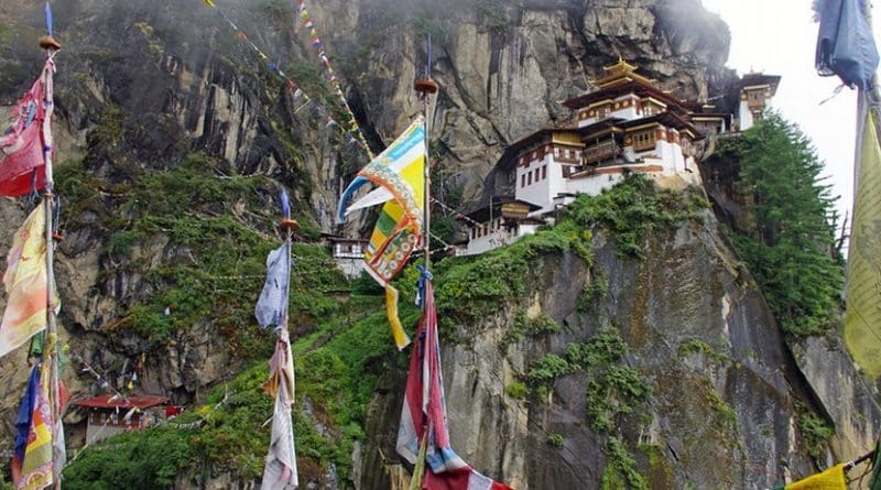
The Bhutan Himalayas lie towards the eastern end of the Himalayan Arc and geologically it extends from the Siwaliks in the sub Himalayas to sedimentary rocks of lesser Himalayas gradually moving into metamorphic zones of Higher Himalayas.
It is recommended that the Geology and the Geomorphology of Bhutan can be best understood by watching a presentation by two Research professors of University of Bristol in the YouTube. What is important to note is that with the Indian plate still moving and pushing the Asian plate that started 50 million years ago there are still very active existing fault lines which over time have become even more active now.
Briefly the Report examines the preparedness of the Government of Bhutan in the event of a major earthquake. It also identifies major risk areas in case of a big quake and what can be done to strengthen resilience and recovery. Reference is made more of the earthquake in Sikkim of 2011 and Mongar in 2009. The highlights of the report are
- The greatest concern relates to collapse of building structures and subsequent effect on human lives and injuries. Seismic design buildings were made mandatory only after 1997 while most of the existing buildings predate this time and are vulnerable.
- 66 percent of the buildings in Bhutan are built under traditional methods using rammed earth /masonry of more than one metre thickness that provides considerable safety. But of late this norm of one metre has not been adhered to and has been reduced gradually with a view to cut costs and this will reduce resilience.
- Road transport network will be cutoff due to landslides resulting in multiple blockades and this will have a major impact on the main Highway from Phuuentsoling- Thimpu- the life line to the capital of Bhutan. Another vulnerable pinch point is said to be Wangduephodrong.
Bridges will be most vulnerable and there are 361 motorable bridges and 420 non motorable bridges.
- Another area of concern will be telecommunications. Bhutan is said to have 650,000 mobile connections and 20,000 land connections. Both will be disrupted in a severe earthquake as Mobile towers will also be affected. Dzonkhags have satellite phones but it has been the experience that it takes longer to get connections.
- Assessment for Health Sector has been more encouraging, and efforts have been made to make the buildings housing these facilities are strengthened to ensure structural and non-structural safety, for fire, electrocution, faults and collapse of buildings.
- The report indicates that the rural sector will equally be affected in terms of food stuffs as it is dependent on imports of rice from India which again will be affected in case of a transportation breakdown.
The Food Corporation of Bhutan is said to have only 3-4 days of supply. This is one area that needs attention and follow up action. Unlike Nepal which have too many towns and crowded places, Bhutan has only 4 major towns Thimpu, Pheuntsoling, Paro and Gelephu. All these towns have water sources nearby and there would be no shortage of water.
- Perhaps, Bhutan may be most vulnerable in case of fuel as it has normally a supply for 3 to 6 days and could be extended by rationing to 9 days. Roads may be blocked, and fuel cannot be transported.
Another area of concern should be the structural stability of the fuel depots- whether these can withstand a major earthquake
- On the geological side, there could be an impact with glacial lake outbursts, landslides. There could be damage by fire, depletion of energy sources, fuel, and even access to safe drinking water.
In all it is a very courageous attempt to review the general preparedness in the event of a major earthquake of magnitude over 7. It is a good effort that would need fine tuning, but it is better to be prepared rather than be taken surprise. Perhaps the effects of the Nepal earth quake which repeatedly registered over 7 on the Richter scale may be studied as Bhutan lies in the same unstable Himalayan zone.
The author was a Geologist and has done research on the international river systems of Nepal.