
Dramatic Images Of 6 February 2023 Turkey Earthquake Reveal Details Of Motions Of Tectonic Plates
The Feb. 6, 2023 earthquakes of eastern Turkiye were the most devastating in the region for the past century.
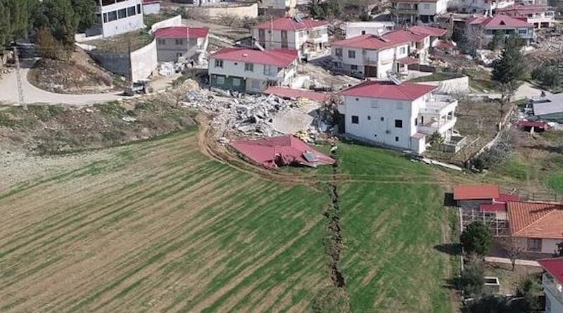
Researchers from China University of Geosciences, US Geological Survey, and Middle East Technical University were on the scene one day after the quakes, and used drones and field surveys to make the most detailed maps of a major continental earthquake ever, so soon after major earthquakes.
The surface deformation, together with the geophysical data show that the rupture sequence started slowly on the Africa/Arabia plate boundary, and when the rupture hit the Arabia/Anatolia boundary, it exploded, like a bullet hitting a bomb, and activated the entire East Anatolian fault system, causing the vast destruction.
Lessons learned will help protect other communities in earthquake prone areas in the future.