
Closer, Cheaper, Compatible: The Case For India As Bangladesh’s Primary Teesta River Partner – OpEd
By Ashu Mann
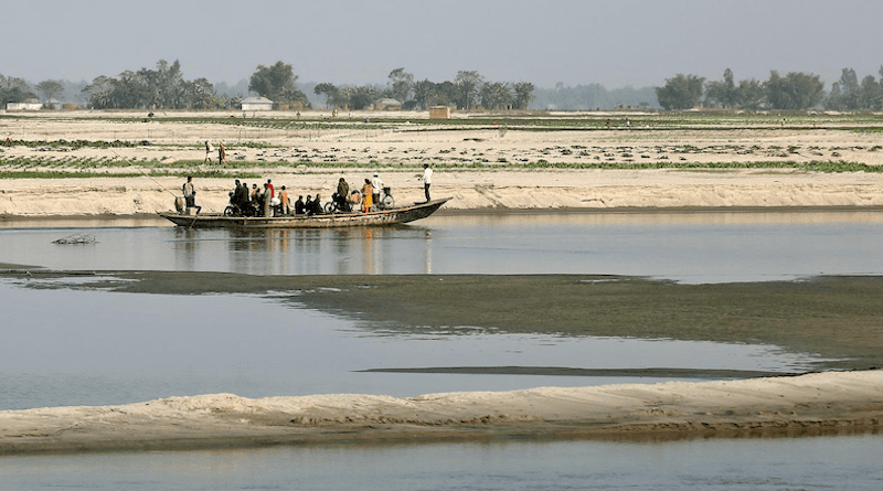
The Teesta does not rise in Beijing. It does not pass through Yunnan, skirt the Tibetan Plateau, or cross a single Chinese province. The river begins in the eastern Himalayas, flows roughly 414 kilometres through Sikkim and West Bengal, and only then enters Bangladesh through the Rangpur division. That geography is not a footnote. It is the strongest argument for why India, not China, is the logical, technically superior, and strategically safer partner for the Teesta River Comprehensive Management and Restoration Project (TRCMRP).
The current trajectory points elsewhere. After the fall of the Hasina government in August 2024 and the rise of an interim administration under Muhammad Yunus, Bangladesh moved toward Chinese financing for the project. Dhaka’s water resources ministry wrote to the planning commission in May 2025 flagging Chinese loan support, and the Economic Relations Division followed up with the Chinese embassy weeks later. The clearest signal came when Yunus visited Beijing that March: the resulting joint statement had Bangladesh explicitly welcome Chinese companies’ participation in the TRCMRP, the first time such language had appeared in a bilateral document. That pivot was driven by political recalibration, not technical logic, and it deserves scrutiny.
The Basin Geography Argument
The most basic case for an Indian partnership is one of basin geography. India is not a neighbouring state with financial ambitions bolted on. It is an upstream co-riparian whose territory feeds the Teesta before the river ever reaches Bangladesh. Any serious management plan for flow, flood cycles, and sediment load has to account for conditions upstream in Sikkim and West Bengal, and India already manages those conditions day to day rather than needing to be briefed on them.
A Chinese partner would be managing a river it does not share, modelling conditions it cannot directly monitor, and standing up institutional infrastructure in a basin where its knowledge is necessarily secondhand. That gap shows up as cost. Joint hydrological monitoring, real-time data-sharing, coordinated reservoir operations during monsoon peaks, and emergency flood response all depend on institutional proximity and physical access that India already has and that China would have to build from nothing, at a price ultimately passed on to Bangladesh.
The Data Advantage
Decades of Indian hydrological study on the Teesta amount to an asset no outside power can replicate on a feasibility-study timeline. India and Bangladesh have run a Joint Rivers Commission since the 1970s, and while that body has stalled on the water-sharing treaty itself, it has built up a base of river morphology data, seasonal discharge patterns, flood frequency analysis, and sedimentation records that matters enormously for sound project design. Sheikh Hasina made a version of this case herself in 2024, telling reporters she preferred India for the project precisely because India already controls the river’s upstream flow through its dams and infrastructure.
China’s engagement with the Teesta starts from a comparative data deficit. PowerChina, the state-owned firm handling the project, has seen its master-plan timeline pushed back, with Bangladeshi officials describing a deadline extended out to 2026 — a delay that reflects the real difficulty of approaching an unfamiliar river system from outside. Existing Indian hydrological records would allow for faster, more accurate infrastructure design, cutting the risk of cost overruns, mis-calibrated embankments, or poorly sited reservoirs of the kind that have plagued externally designed river projects elsewhere in the Global South.
The Ecological Alignment Factor
The Teesta basin is an ecologically sensitive corridor linking the eastern Himalayas to the Bengal delta. Its floodplains, wetlands, and farmland sit inside a larger ecosystem that India and Bangladesh already share and jointly strain. Similar agricultural calendars, comparable monsoon dependence, and overlapping riverine biodiversity mean an India-led project would start with ecological familiarity built in, and the incentives line up: a poorly designed Indian-led project would damage India’s own border districts just as much as Bangladesh’s.
China’s record on shared rivers gives reason for caution. During the 2017 Doklam standoff, India reported that China had stopped sharing hydrological data on the Brahmaputra and Sutlej under an existing bilateral mechanism, contributing to flood damage in downstream Indian states; China’s stated explanation at the time was that monitoring equipment had been knocked out by flooding, though the timing fed suspicions of a political motive. Whatever the cause, a partner whose data-sharing has gone dark during a bilateral dispute is a strange choice to entrust with engineering a river that millions of Bangladeshi farmers depend on for irrigation and food security.
The Strategic Dimension
India’s wariness about Chinese involvement in the Teesta project also runs through the Siliguri Corridor, the narrow strip of land connecting India’s northeast to the rest of the country, which sits close to the project site and makes any Chinese physical presence there a live concern in Indian security planning. Bangladesh has little to gain from turning the Teesta into a stage for Sino-Indian rivalry, and a deeper Chinese footprint in the project only raises the odds that it becomes a site of contestation rather than cooperation.
India’s own interest in the project is driven by security concerns and a desire to keep the region stable. Those motives are self-interested, but they happen to line up with Bangladesh’s own long-term interest in a neighbourhood that isn’t a venue for great-power competition.
None of this is an argument for India out of sentiment. It is an argument built on geography, data, and shared ecological stakes. The river runs through India first. The records sit in Indian archives. The coordination costs are lower with a partner who already knows the basin rather than one still reading its atlas.