
Emerging Deforestation Frontier In Southwestern Amazon Sees Increase In Burnings
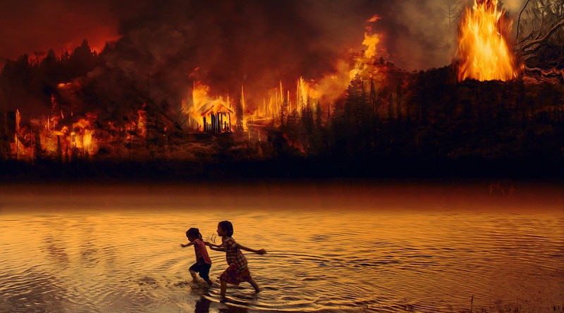
A swathe of the Amazon Rainforest almost twice the size of Luxembourg was destroyed by fire between 2003 and 2019. The area is in the southwest of Amazonas state, in Brazil’s North region, and includes parts of nine municipalities with some of the worst sustainable development indicators in the country. Deforestation had been increasing in the area, largely owing to illegal logging and other activities linked to agriculture along two highways that run through it.
In the period 2003-19, fire destroyed 4,141 square kilometers (km²) of forest, of which 3,999 km² was primary (native) vegetation. A year-by-year breakdown shows that the area affected by fire ranged from a low of 33 km² in 2011 to a high of 681 km² in 2019. In addition, 6,484 km² of pasture and crops burned down in the period.
These numbers are from an article published in the journal Fire reporting a study by scientists at the National Disaster Surveillance and Early Warning Center (CEMADEN) and the National Space Research Institute (INPE), both of which are Brazilian institutions, in partnership with colleagues at universities and other research institutions in Brazil and abroad.
According to the article, which focuses on Boca do Acre, a municipality in Amazonas state, loss of vegetation due to deforestation increased the occurrence of burned areas, resulting in transformation of the landscape from forest to cropland and pastureland, especially in the vicinity of highways BR-317 and BR-364.
Factors such as intensification of the dry season and more frequent extreme weather events also made the region susceptible to anthropogenic (human-induced) fire. Moreover, the accumulation of organic matter from deforested areas fueled ongoing fires, which spread as a result.
On the other hand, protected areas such as conservation units and Indigenous territories acted as a barrier against deforestation. Fire destroyed only 189.13 km², or 1.3% of the total, in the period 2003-19, mainly near roads and farms in the Boca do Acre and Apurinã Indigenous Territories.
“Our study identified the extent and frequency of fires, and the correlations with changes in land cover and climate, pointing to priority areas for conservation. We also analyzed the susceptibility to fire of forest on undesignated public land and adjacent to rural properties. This is troubling. More recent deforestation is increasingly close to protected areas, which thereby become even more vulnerable,” said Débora Dutra, first author of the article. She is an environmental and sanitary engineer and a researcher at CEMADEN, with a scholarship from FAPESP.
Undesignated land is government land that has not been assigned to a specific use, such conservation or settlement. This category is the most vulnerable to encroachment by land grabbers and squatters.
For Liana Anderson, also a researcher at CEMADEN and supervisor of Dutra’s master’s research, in addition to its detailed analysis of fire patterns in the area, the study also evidenced how fire is advancing through the Amazon Rainforest. “The region is known as the new deforestation frontier,” she said. “A first wave devoured the forest from Mato Grosso [a state in Brazil’s Center-West region], and the fires then moved on up into Amazonas state. This area is under pressure, but conservation units and Indigenous territories have served as barriers, emphasizing their importance to maintenance of the forest and its socio-biodiversity.”